Freight in New York

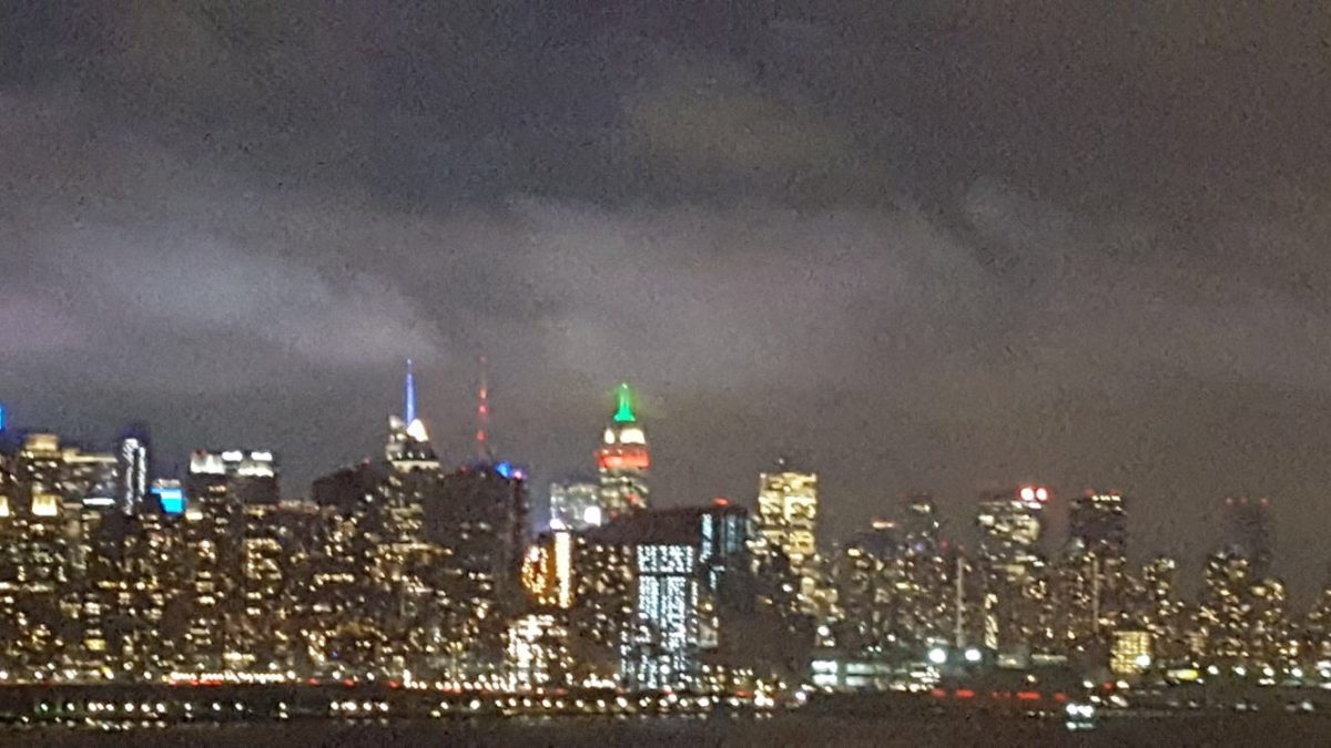
New York is one of the largest ports in the United States and a point for cargo coming into and leaving the country.  As an island and at the entrance of the Hudson River, the position of the city forms a natural choke point for passengers and especially freight heading to Upstate New York, New England, and Long Island.  This article will cover some of the freight infrastructure that keeps New York going.

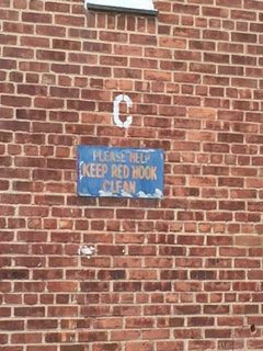
As mentioned on many Sights by Sam tours, the Port Authority of New York and New Jersey (PANYNJ) operates the seaport of the region.  The port, which is concentrated on Staten Island and around Newark and Elizabeth, New Jersey, handles millions of tons of cargo per year.  As it has grown, the PANYNJ may expand port operations for a small berth in Brooklyn at the historic Red Hook piers, which was the site of break-bulk cargo operations (and is famous for being where On the Waterfront took place).  The port has also been expanded to handle post PANAMAX ships (a project that included raising the Bayonne Bridge from 155 feet high to 215 feet high).

In terms of freight rail, the most famous piece of infrastructure is the High Line linear park (which can be seen on the “Architecture: Building New York” walking tour from Sights by Sam).  As New York is dense and on islands for the most part, it is not the easiest place to operate a freight railroad.  Before the opening of the Holland Tunnel, rail ferries were popular for freight—passengers had to take ferries from New Jersey rail terminals until the Hudson and Manhattan (today the PATH train) and the Pennsylvania Railroad tunnels opened in the early 1900s.   While the PANYNJ does operate a ferry for rail cars to move from Jersey City to Brooklyn, it remains little-used compared to truck traffic and mostly is used to load and send the city’s garbage to landfills in distant areas.

On the subject of trucks, New York would stop without the army of trucks hauling 400 million tons of cargo into the city annually.  Of late, there has been a large increase in the use of trucks due to the proliferation of online shopping and home delivery services, both of which employ delivery vans to come directly to a consumer’s building.  As there is a prohibition on most 18-wheelers in the Holland and Lincoln Tunnels, the vast number of goods vehicles are box and medium trucks, in addition to customized vans.  The number of them has been increasing and has led to calls for limits on their loading times—they frequently double park on busy roads and must be driven carefully to avoid hitting people, bicyclists, and other motorists.  The NYPD issues thousands of dollars worth of fines daily to these conveyances (with some delivery companies settling out of court every year with the city regarding their summonses).  A freight rail tunnel has been proposed by Manhattan and Bronx politicians to reduce air pollution in their districts, but the measure is opposed by political interests in Brooklyn and Queens, as they feel the truck traffic will simply migrate over to them.

As you visit and walk around the city, remember that all of the consumables, goods, and other objects had to arrive in town somehow.  Since its founding in the 1600s, New York has been a center of trade and freight transportation.  The city and other regional governments are working to ensure that New York remains competitive with other freight handling centers into the next decades.  This is the type of information you will learn on a Sights by Sam tour.

Electric New York

Aside from Las Vegas and Tokyo, New York is probably the most famous city that is flooded with electric lighting.  The lighting comes in many colors, illuminates homes and businesses at affordable prices, and gives the city its “city that never sleeps” reputation.  Electric lighting has had one of the most profound effects on the evolution of the metropolis.  Its history is quite interesting and made New York what it is today.

Electric power was invented in the early 1800s and had sporadic demonstrations through most of that century.  Supposedly on the same day as Edison’s light bulb made the newspapers, the display of an electric streetlight was made in Lower Manhattan by the Electo-Dynamic Light Company, a company formed by a man from Brooklyn and a man from Manhattan, according to the New York Times.  The technology became viable in the 1870s when Thomas Edison patented a Direct Current transmission system.  After conflicts between rival power formats, Westinghouse and its AC/DC hybrid system won out against Edison’s DC system.  Once the technology became commercially successful, electric lights and signs started popping up all over New York—leading to Broadway becoming the “Great White Way” by the 1890s.  Theaters also replaced gaslights with electric lighting, removing the threat of fire and also noxious gas building up in enclosed spaces. This coincided with the city replacing gas lamps with electric lights in most parts of the city.  In the coming decades,  electric lighting systems would be added to buildings.  By World War II, neon signs and fluorescent lighting (first shown in the 1939 World’s Fair in Queens) would become commonplace.  Electricity also helped to power the subway system, leading to the end of soot-belching elevated train locomotives and providing clean power to the transit system.

As the need for electricity grew, the city developed a vast electric power grid that stretches deep into Upstate New York.  While many facilities inside and outside of the city were originally powered by coal, the region now receives its power through nuclear, natural gas, and hydroelectric power.  Thousands of miles of power cables snake through the city and the metropolitan area.  Consolidated Edison is the city’s main electric utility, providing electricity to consumers over a 660 square mile service area.  According to the New York Times, the peak load on the grid is at evening rush hour when commuters are going home and students return from school and power up computers, video game consoles, and charge cell phones.  Because of the demand for maintaining infrastructure in the city and very strict New York State regulations on electricity generation, residents of the city pay some of the highest electric bills in the country.

Some of the most famous places to see electric lights in the city are at Times Square (where city ordinance mandates the placement of electric billboards), the tops of tall buildings (including the Empire State Building, One Bryant Park, and Four Times Square), and through Koreatown in Manhattan.  Pell Street in Manhattan Chinatown and Flushing, Queens are also great locations to see lights (and get great food).  Building on the success of the subway being powered by electricity, the MTA is powering many new buses by electric-hybrid engines and many city vehicles are gradually becoming battery powered.  Electric lights can be seen in their blazing glory on the legendary “Nighttime Manhattan-Crowned Heads” tour with Sights by Sam.

Haunted New York

As the largest city in the country, New York is the home of millions of residents.  While the city is known for having the most living souls in the USA, there are many lost souls and undead residents that are supposedly left in the city.  New York is littered with locations that have been the alleged sites of hauntings and paranormal activity.  In the spirit of Halloween, this blog will conduct a quick survey of haunted locations in the city.

As a major port into the Eastern United States, New York has been the collection point for ships and cargo since the Colonial and Antebellum Eras.  The city is full of spooky stories regarding shipping.  There are unconfirmed reports of women in colonial dress waiting for their husbands or ships that never arrived to the city in Lower Manhattan.  They are often found in the dead of night near former East River docks.  The Merchants House Museum (which is shown on the Sights by Sam “Around the Villages” tour) is the site of a haunting by the ghost of Gertrude Tredwell, who was an unmarried daughter of Seabury Treadwell.  Another ghost sighting from the Colonial Era is that of the final Dutch governor of New Amsterdam, Peter Stuyvesant.  It is said that Stuyvesant’s ghost walks around the St. Mark’s Church-in-the-Bowery, which was constructed over his estate, as well as his tomb.

Ghosts are not limited to the Colonial Era.  Ghost trains (and their frantic passengers) have been reported by perplexed workers at Grand Central Terminal and by repairmen on the Hell Gate Bridge.  Some famous specters such as Dylan Thomas have been sighted stealing drinks at the White Horse Tavern in Greenwich Village while the girlfriend of Sid Vicious (Nancy Spungen) is thought never to have left the room at the Hotel Chelsea in which she was murdered.  Additionally, the original proprietors of theaters such as the Belasco and Radio City Music Hall are thought never to have left.

Although not the sight of any occult happenings, the annual Village Halloween Parade has occurred for the last 44 years up Sixth Avenue.  At this event every October 31st, New Yorkers dress in their scariest costumes.  Admission is free and any New Yorker in costume can march in the parade.  To arrange a tour of haunted sites (or anything within New York), please contact Sights by Sam for a scary-good tour at +1 (917) 242-8421 or sightsbysam.com.

Public Art

In addition to having some of the greatest museums in the country and the world, New York is blessed with an abundance of public art. Many artists are drawn to the city (and arts are funded by both private donors as well as the local government). This leads to many great public art displays (sanctioned by the government, companies, property owners, and some unsanctioned displays). Public art can be seen in all five boroughs.

The city has been the site of several large public art installations. These have proliferated since the early 1980s when the city passed a “Percent for Art” law in 1982 that mandated that city-funded construction projects must have a set-aside of one percent of the budget for public artwork. This is also supplemented by a similar program by the Metropolitan Transportation Authority (MTA Arts and Design). What this means is that there are many art installations and pieces in front of city-owned buildings and in subway stations. Over the years, several have been controversial, such as a sculpture in the Civic Center called Tilted Arc, which was a 120’ long block of cor-tenn steel across a plaza, which was removed after a court trial. One of the most famous pieces was done in 2005 by artists Christo and Jeanne-Claude in Central Park called The Gates, which contained 7,503 orange gates spread throughout the park.

Much of New York’s public art not found in front of city-owned buildings or sponsored by companies can be traced to the work of the city’s Public Art Fund. Founded in 1977 by Doris C. Freedman, the Public Art Fund is a nonprofit organization that seeks to bring public art to spaces across all five boroughs. The goal of the organization is to bring contemporary art to the population of the city. A popular space for the public art fund to exhibit its works are at the entrance to Central Park at Grand Army Plaza in Manhattan and at Brooklyn Bridge Park near the eponymous bridge. Some of the most famous/most talked about pieces include New York City Waterfalls in 2006 and the 2017-2018 Good Fences Make Good Neighbors sculptures by Ai Weiwei.

As New York is full of art, visitors are able to see art on any Sights by Sam tour. Reserve your place on one of the exciting Sights by Sam walking tour by calling +1 (917) 242-8421, or through sightsbysam.com today.

LaGuardia Airport

Visitors to New York come into the city in several different ways. For visitors coming from Denver and cities east of the Rockies, many will arrive at LaGuardia Airport. While many believe that the airport does not provide the best introduction to the city (some people say, “the only good thing about it is whom it is named for”), LaGuardia Airport has a storied history and is looking toward a better tomorrow.

In 1929, an amusement park in Queens on the water in Elmhurst was demolished to build a general aviation airfield. This airfield would later be pressed into commercial service in the 1930s when Mayor Fiorello LaGuardia of New York was returning from a meeting by airplane. His flight landed at EWR airport in Newark, NJ. LaGuardia was upset that his ticket had said “New York”, but the aircraft landed over 15 miles away in another state. LaGuardia had the pilots land their aircraft (after the other passengers had disembarked) at Floyd Bennett Field in Brooklyn, where he held a press conference exhorting the need for an airport in the city. It would not be long before the small general aviation field would be expanded and named after Mayor LaGuardia (against his wishes). LaGuardia Airport was sited on the Long Island Sound, as many flying boats flew internationally in those days (the Marine Terminal at LaGuardia is testament to this). Over time, LaGuardia grew too busy to handle the traffic and the city began quietly buying up land (and the Idlewild Country Club) in Jamaica, Queens to build a second, larger commercial airport (now the well-know JFK International Airport).

Today, nearly 30 million passengers fly into the airport. The cramped four terminals are often the subject of complaints by angry travelers and civic boosters seeking a larger, more orderly, and spacious facility. The Port Authority of New York and New Jersey (owners and operators of LaGuardia Airport since 1947) has planned a $4 to $5 billion construction effort to tear down three of the separate terminals and combine them into one continuous, modern facility. Additionally, the airport will be connected to the NYC subway’s 7 train via a people-mover system. Construction began in 2016 and is expected to conclude in the early 2020s. This is the type of information you will learn on a Sights by Sam walking tour. Alternatively, you can soar through Queens on a privately-led Sights by Sam tour of nearby Flushing Meadows-Corona Park or the Louis Armstrong House—to name but two great sites near the airport.

Sunset Park

New York is a city full of great parks. Every borough contains such treasures, but one of the best can be found in Brooklyn. Although Prospect Park is the most famous of the parks in the Borough of Champions, Sunset Park sits on a beautiful, nearly-25-acre plot that provides commanding views of the surrounding neighborhood and views of Manhattan.

The neighborhood developed in the 1800s with the creation and development of the port of Brooklyn and nearby Industry City. When the port was working at full steam from the middle of the Antebellum Era through the end of World War II, it attracted many Scandinavian immigrants who settled in the immediate area (so that they could work at their jobs at the port). This settling activity led to the spread of cooperative housing in the neighborhood (and later throughout the city). There was a lot of port activity at the Brooklyn Army Terminal. The neighborhood began to decline after World War II with a downturn at the port and the completion of the Brooklyn-Queens Expressway.

The Scandinavian population left and the neighborhood became populated by Latino people. They would be joined by Chinese in more recent decades who have established a lively commercial district along 8th Avenue. The main attraction of the neighborhood is of course the park, which was established in the 1890s. It is perhaps most famous for its grand vistas and recreation center built in 1936. This is the type of information that you will learn on a Sights by Sam walking tour. To see the fabulous park and to explore this great neighborhood, contact Sights by Sam at +1 (917) 242-8421 or through sightsbysam.com to book a custom tour today.

Red Hook

On the western edge of Brooklyn lies Red Hook, a former shipping area. Known for its starring role in movies and for its industrial appearance, this neighborhood is now on the rise after decades of neglect. The neighborhood is now sporting many new businesses between older industrial facilities that once served the main port of the East Coast of the United States.

The Dutch were the first Europeans to settle the area in the mid 1600s—naming the area as “Red Point” for its red soil. The name was anglicized to Red Hook, as the Dutch word for “point” is similar to the English word for “hook” in appearance. With the construction of the Gowanus Canal, the area became very industrial and served great commercial ships. This neighborhood was the location of the famous 1954 film On the Waterfront. This movie was filmed at a time when containerization and changing economic times were forcing the port around Red Hook to become gradually abandoned. With the combination of deindustrialization and the building of the Brooklyn-Queens Expressway, the neighborhood was literally and figuratively cut off from jobs. This led to a deep depression in the area—especially among residents of the very large housing projects dominating the section.

With falling crime and increased investment throughout New York, Red Hook has benefitted. The neighborhood is the site of an IKEA furniture store and an upper-end Fairway grocery store, in addition to other new shops. An increasing population, gentrification and better transportation connections with the rest of the city are the top issues for local residents. This is the type of information you will learn on a Sight by Sam tour. To see Red Hook on a walking tour, please contact Sights by Sam at +1 (917) 242-8421 or through sightsbysam.com.

Queens Museum

Queens is the largest borough in terms of area and the second largest in population. The borough is one of the most diverse with regard to its inhabitants, and it contains such varied sites as wetlands, pro sports teams, and even beaches. One of the most interesting places in a borough of interesting places is the Queens Museum.

Housed in a building from the 1939 World’s Fair, the Queens Museum does a great job of explaining its past as the New York City pavilion in both the 1939 and 1964 World’s Fairs and as a temporary home of the United Nations from 1946 to 1950. This was the building where the U.N. deliberated about the formation of the State of Israel. Its site near the Unisphere of the 1964 Fair helps visitors find this unique institution. In addition to temporary exhibits relevant to residents of Queens, there are two main exhibits of note to visitors: the Panorama of New York City, which is an incredible exhibit showcasing the nearly 900,000 legal structures in the city (last updated in the early 1990s) and a map of the New York City watershed completed during the Great Depression for the 1939 Fair (but never displayed). Both the Panorama and map of the NYC watershed put the vastness of the city and the resources needed to keep it afloat into perspective. There is also an excellent collection of Tiffany lamps and memorabilia from the World’s Fairs.

In addition to the museum collection, there is also a small gift shop that has a great selection of goods about Queens and its history. The museum makes an excellent stop on an Outer Borough adventure. This is the type of information you will learn on a Sights by Sam walking tour and can be seen on a special request tour of Flushing Meadows-Corona Park.

DUMBO

Brooklyn is the most populous of the five boroughs of the city. For most of its storied history, the borough was known for its industry. Facilities such as the Brooklyn Navy Yard and several factories producing items that included sugar, brillo pads, and pencils (to name but a few of the many commodities) dotted the landscape of Kings County. Among the most famous industrial areas (which has changed and is no longer such) is Down Under the Manhattan Bridge Overpass—or, DUMBO.

Long a manufacturing area, the DUMBO neighborhood was known by many names throughout its history. The tall lofted buildings were ideal for factories when they were built, but they became obsolete in the era after World War II. In the postwar period, the lofts were abandoned but gradually became used by artists, writers, and other creative types starting in the 1970s. Not only were the lofts sought after, but there are also cobblestone streets in the district. The great views of the Manhattan skyline, access to the subway, and the bridge led to the gradual rising popularity of the neighborhood. The DUMBO name moved from a term used by realtors to one commonly used by many in the city. A citywide reduction in crime starting in the 1990s helped to make the area more desirable to visit and live.

As the neighborhood began to increase in popularity, the rents and cost of land gradually increased. This neighborhood is now the site of several corporate headquarters such as West Elm and Etsy. DUMBO is becoming more popular with the recent completion of Brooklyn Bridge Park, bringing more people to this great part of the city. In addition to learning about this neighborhood on a Sights by Sam walking tour, see the area on our “Borough of Brooklyn” tour.

Washington Heights

As mentioned in the previous post, the George Washington Bridge Bus Station forms a crucial lynchpin in the city’s transportation network. In addition to this building and bridge being named after our first president, the adjoining neighborhood of Washington Heights is one of the most historic and fascinating in the city. As it was a rural area for a lot of its history, stately homes and other historic sites abound in this neighborhood.

For much of its history, Washington Heights was countryside. It featured prominently in the American Revolution, as it was the headquarters for George Washington and the Continental Army during the crucial Battle of New York in the summer of 1776. The neighborhood remained relatively bucolic until the late 1800s, when property developers started to build apartments and houses. The neighborhood gradually gained population until there was a major influx of people between World War I and World War II. During this time, thousands of German and Polish Jews fled to the area, making it a haven for Central Europeans escaping from persecution. After World War II, the neighborhood would become populated by people from the Dominican Republic, creating one of the largest enclaves of people from the eastern part of Hispanola in the U.S. After falling on hard times due to the spread of crack cocaine in the 1980s, Washington Heights has been experiencing a revival in recent decades, becoming a very sought after neighborhood as land and housing prices in Manhattan continue to rise.

Washington Heights contains not only grand apartment houses but also The Cloisters (covered in another Sights by Sam blog entry), the Dyckman House, and the site of Fort Washington. In addition to learning this information on this blog, you will be able to soon tour this exciting neighborhood on a new Sights by Sam walking tour.