Act of Consolidation

Although there are larger cities in terms of area in the U.S. than New York (Jacksonville, Florida, covers more area), and there are other cities around the world that have more inhabitants, New York remains the largest city in population in the U.S. and still covers a large area (at over 300 square miles).  The current boundaries of New York date back to 1898.  The ramifications of this merger (called the Act of Consolidation) are still felt today.

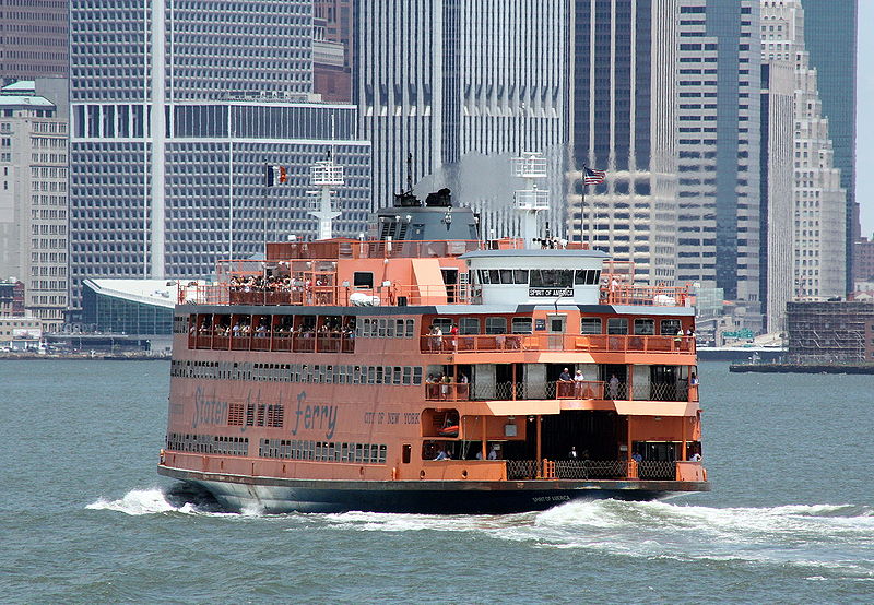
New York eclipsed Philadelphia as the largest city in the U.S. by the time of the first census.  As New York grew, the neighboring cities also increased in population.  This was most notable in Brooklyn, which would eventually become the country’s fourth largest city.  As the population of the region increased, it was becoming apparent that one city government would function in a more efficient manner.  After the Civil War, Brooklyn and New York had combined fire and police departments.  The addition of the Brooklyn Bridge also helped to draw the two cities together even more.

Much of the opposition to consolidation came from Brooklyn politicians, who naturally feared their loss of control in the new city.  Their protests were drowned out by citizens in Brooklyn, who were upset about corruption scandals in the City of Brooklyn and that the municipality was having trouble finding clean water—while New York had a reliable source of fresh water piped in from the Catskill Mountains.

In 1896 the State of New York approved a consolidation of the City of New York (which included Manhattan and the Bronx), the City of Brooklyn, Richmond County (Staten Island), and Queens County.  Areas of Queens County rejected the consolidation and split off (with state approval) to become Nassau County.  The Bronx would be spun off into its own borough before World War I.  Under a new city charter, the city council would acknowledge the roles of the separate boroughs with an upper house called the Board of Estimate, which included the mayor, city council president, comptroller, and the five borough presidents.  This chamber was declared unconstitutional in the 1980s and abolished.

While some say that the Act of Consolidation marked a great decline for many years for Brooklyn (the city lost its professional baseball team and independent newspapers in the ensuing years) and Staten Island (which has unsuccessfully tried to separate from the city several times due to a perceived indifference from the city government), it has been argued that the consolidation was beneficial as it helped to streamline government throughout the region and helped to develop the metropolis into what it is today.  Information such as this is explained on every Sights by Sam tour.

What’s in a Name: A Brief History of the Borough Names

Traversing through New York City, named after King Charles II’s brother, the Duke of York, many new arrivals and some long time residents have wondered why the boroughs have their names.  This short guide should explain why the boroughs are called what they are:

Manhattan

The origins of the name are not agreed upon.  The name Manhattan could be a Dutch corruption of a Lenape or Munsee word for “Place of Many Hills”, “Place Where One Gathers Bows,” or the oft-quoted “Place of General Inebriation.”

Brooklyn

Brooklyn is named after Breukelen, a Dutch village.  Various sources say this further translates into “the Broken Land.”

Queens

This borough was named for Queen Catherine of Braganza, the wife of King Charles II, who was the sovereign when the English took what became New York from the Dutch.

Bronx

This area was named after Jonas Bronck, a Scandinavian settler (who was believed to be Danish, Swedish, or Norwegian, depending on who you ask) who was a major landholder in the area in the 1600s.

Staten Island

Staten Island was named by Henry Hudson for the Staten Generaal, then the name of the Parliament for the Netherlands.  In 1683, the island was reorganized into Richmond County, named after the Duke of Richmond, illegitimate son of King Charles II.

The naming of the city itself and the outer boroughs follows a consistent pattern with the Age of Discovery in naming areas after important people or landowners (this pattern is repeated all across the U.S., Canada, Australia, and New Zealand), or as a linguistic corruption of already existing local names (which was common at one point in India and is still common in many New York neighborhoods).  Another entry regarding some of the neighborhood names will come at another time.  You are able to learn this and other history like it on a Sights by Sam tour.

The Yellow Cab

One of the more ubiquitous symbols of a city are its taxicabs.  London is known the world over for its black cabs.  Hong Kong is known for its color-coded fleet of Toyota Crowns, and Indian cities have 1950s-vintage Hindustan Ambassador cabs plying their lanes.  New York is well represented by the yellow cab.  These conveyances form a crucial piece of the city’s transportation network, giving native and visitor alike a bumpy experience on their way between points A and B.

Cabs were first instituted in New York when horses still strode through the city.   Motorized taxis replaced carriages in the early 20th century.  Until Mayor LaGuardia was elected in the 1930s, the industry was largely unregulated.  During the height of the Great Depression, the city instituted a system of medallions to cut down on the number of taxis in the city (it was estimated that over 30,000 cabs were on the streets, with many not being able to collect any fares).  In 1967, the color of the cabs was set as yellow to make official taxis instantly recognizable (according to one legend, it was the police commissioner’s wife’s favorite color).  Yellow cabs tended to concentrate in Manhattan and around the two airports in the city, leading to vast areas of the city being underserved.  This led to black livery cars (illegally) picking up fares in the outer boroughs and Uptown Manhattan.  The advent of the borough taxi program in 2012 led to a fleet of lime-green taxis allowed to pick up in the Outer Boroughs and in Uptown Manhattan in order to bolster cab numbers and bring on-demand transportation to these areas.

Current estimates state there are over 13,000 cabs in the city.  They are regulated by the city’s Taxi and Limousine Commission.  These include both yellow and borough cabs.  In recent years, taxis have been facing increased competition from rideshare services, bringing the value of medallions down (which were at one point in the millions).  In the mid-20th century, many cab drivers were driving as a way to make extra money or as a second job.  Today, most drivers are recent immigrants to the city and country.  Although not of note to most visitors, city law prohibits cars used as cabs from serving in that capacity for more than five years, regardless of mileage.

You may be using a cab to arrive at or leave from a Sights by Sam tour.  Remember when riding in a taxi to buckle up, note the number of the cab (which will follow a 1A23 format if yellow or AB123 format if a borough taxi).  You should also remember to take your items with you as they may not be found again if you leave them.  It may also be hard to hail a cab between 4 and 6 PM (as this is during a major shift change for most cabs).  Despite rumors to the contrary, most cabbies are courteous and know where they are going.

Manhattan Chinatown

Situated between the Civic Center and the Lower East Side is Chinatown, one of the defining neighborhoods of Manhattan.  Up to 100,000 people, including recent immigrants and families that have lived in this part of Manhattan for over a century, all crowd into this area.  Chinatown remains one of the most vibrant neighborhoods in terms of sights, smells, and tastes (some of the best restaurants in town are located here).

It is believed that Chinese arrived in New York right before the Civil War and settled in the immediate area around Pell and Doyers Street.  As more Chinese (soldiers and laborers) came to New York, discrimination against them increased.  Chinese men (it was mostly men who immigrated) often joined secret societies (tongs) that often warred against each other.  It is believed that conflict between tongs using hatchet men (hatchets were the weapon of choice) led to Doyers Street in Chinatown becoming the scene of the most murders of any spot in the city.  After immigration reform in 1965, the population of Chinatown exploded and the neighborhood expanded its boundaries.  Owing to the original arrivals and more recent arrivals from Hong Kong, Cantonese is the dominant language in Chinatown—but this is slowly changing as the most recent immigrants arrive speaking Mandarin.  The Chinese population in New York now numbers close to one million and counts Flushing in Queens and a Brooklyn Chinatown with Manhattan Chinatown (all linked together by bus companies serving the three locations).

One of the favorite pastimes of Chinatown for visitors is the food.  There are many opportunities to get snacks such as candy, Chinese baked goods, bubble tea, dim sum, or a full-course Peking duck meal.  In terms of more historic sites, Columbus Park (the last surviving part of the old Five Points), numerous temples, and the Museum of the Chinese in America are all available.

Chinatown, for its vibrancy, history, and great food, should be on the must-see list for any visitor to New York.  You are able to see Chinatown on most Sights by Sam tours of Lower Manhattan.


Holland Tunnel

Every workday, the population of Manhattan doubles as an army of 1.5 million commuters storm the island.  Commuters come by land and sea (with what I imagine are quite a few by air as well).  Many commuters and visitors come into Lower Manhattan via the Holland Tunnel, one of the notable crossings of the city.

The idea for a vehicular tunnel crossing the Hudson River was postulated as early as the first decade of the 1900s, following the completion of railroad tunnels by the Pennsylvania Railroad.  Originally, designers wanted a bridge (including some designs of a “London Bridge” motif with buildings on the bridge).  This was shelved as the Hudson River was the epicenter of the Port of New York at the time and it was feared a bridge’s construction would interfere with river-borne commerce.  An innovative proposal consisting of a tunnel consisting of two tubes with two lanes each was agreed upon.

Contrary to popular belief, the Holland Tunnel is not named for the country nor that same country’s association with the city.  The lead engineer of the project was named Clifford Holland, the project’s initial engineer.  Holland did not live to see the project completed, so Norwegian-born engineer Ole Singstad  led the project to completion. Begun in 1920 and completed in 1927, the tunnel was one of the first that was strictly vehicular in the world.  It is now managed by the Port Authority of New York and New Jersey, which runs the seaports, commercial airports, and crossings between New York and New Jersey.

The tunnel is revolutionary in that it solves the problem of pollution by cars with a system of ventilating fans.  Large, high powered fans, via ventilation towers in Jersey City and New York, exchange the air every ninety seconds.  Trucks are not allowed in the tunnel (due to safety restrictions and that the height of the tunnel is about a foot too short for your average semi to enter).  The tunnel is a characteristic white color that is believed to reduce road rage—it is brushed regularly with a special “toothbrush truck” the Port Authority has on hand for that purpose.  About 35 million vehicles use the tunnel annually.

Although existing in the same city as the soaring George Washington and Brooklyn Bridges, the Holland Tunnel is still notable.  Although thousands pass through it every day without noticing, the structure is a remarkable piece of civil engineering and a symbol of human ingenuity.  This is the type of information you will learn on a Sights by Sam tour.

Grant’s Tomb

Given that New York City is the home of only one president (Theodore Roosevelt), it would seem odd at first glance that a president who was born in Ohio and lived much of his adult life in Illinois would be buried there.  With that said, Ulysses S. Grant is the only president interred within the city limits, along with his wife, Julia.  The story of the tomb is compelling and is a comment on changing times in the city.

Grant died of throat cancer in Upstate New York in 1885 (rumored to be from his hard drinking and heavy-smoking ways).  While he was not a memorable president, his command of the Union Army in the Civil War and his influence on warfare gave him everlasting fame.  Grant’s family agreed to have him buried in New York.  An association (the Grant Monument Association) was formed to raise money for and construct the tomb.  After delays regarding its location, funding, and design, the tomb opened in 1897, with the mausoleum patterned off of the Mausoleum at Halicarnassus, one of the Seven Wonders of the Ancient World.  The spartan interior of the mausoleum was decorated in the 1930s with paintings of famous scenes from the Civil War and busts of other great Civil War generals.

The tomb began to suffer serious decay starting in the 1950s, becoming a vandalized, graffiti scarred mess.  The tomb was hardly visited and became a symbol of decay in the city.  Grant’s relatives threatened to remove his and Julia’s bodies to another location if something was not done.  After the National Parks Service was unwilling or unable to do anything,  a Columbia University student successfully got the gears moving by getting the Illinois state government to threaten to move President and Mrs. Grant’s bodies.  The federal government eventually appropriated money to restore the tomb.  The restoration of the tomb was completed in 1997.  In a tomb fit for one of the giants of American history, the interior and exterior are now in immaculate condition.  The interior contains the tombs and scenes of pivotal Civil War moments, such as the surrender of the Confederates at Appomattox.  There is also a collection of flags used in battle in the Civil War.

Although Grant’s Tomb does not figure highly on the itineraries of many visitors, it is an architectural master work and a slightly larger-than-life tribute to a giant of American History.  Grant’s Tomb can be seen on a Sights by Sam tour.

Staten Island: Forgotten New York?

As you learned in a previous entry, Staten Island was named for the parliament of the Netherlands.  The population of the borough stands at under 500,000 and is about 60 square miles.  Despite being part of the city, the island can sometimes seem like a world apart from the rest of the hustle-and-bustle of the city.

Staten Island was discovered in 1524 by Giovanna da Verrazano (for whom the bridge linking Brooklyn and the island was partially named).  The island was lightly settled by the Dutch.  A wave of more settlers came to the island under the British, who incorporated it into the Province of New York and named it Richmond County (for the noble title of one of King Charles II’s sons).  The island was the site of a failed negotiation between British General Howe and several Continental Congressmen at the Conference House in 1776.  A peace settlement in exchange for withdrawing the Declaration of Independence failed, leading to the British invasion of New York.  The island was consolidated in 1898 with the other four boroughs to form present-day New York City.  The borough was also linked to New Jersey by three bridges (Bayonne Bridge, Outerbridge Crossing, and the Goethals Bridge) and to Brooklyn (the Verrazano-Narrows Bridge) in the 20th Century.

While a part of the city, Staten Island residents have not always seen eye-to-eye with the rest of the city.  Some residents feel neglected by the local government—with this having to do with political differences, a much smaller population on the island, and the siting of a large garbage dump on the island between 1947 and 2001.  Additionally, residents have expressed opposition to the lack of zoning restrictions on the island (which the city government hopes will encourage development on the island while some residents believe this will destroy the low-rise character of the area).  A secession vote passed in the 1980s, but was not approved by the State of New York.  Despite this checkered past, Staten Island is very much a part of the city.

During your visit to New York, consider taking in some sights on the island such as the Tibetan Art Museum, Conference House, Old Richmond Town, or a game at the Staten Island Yankees’ home stadium.  At the very least, the Staten Island Ferry is the best bargain in town—it’s free and riders are able to take in New York Harbor at a relaxing pace.  In time, Sights by Sam hopes to be able to add Staten Island to its array of tour destinations.  In the meantime, this is the type of information you will learn on a Sights by Sam tour.

Bowling Green: First in New York

New York has hundreds of public parks ranging from the massive Pelham Bay Park in the Bronx to small “parklets” that are scarcely larger than a parking space. At the foot of Manhattan sits Bowling Green, the oldest public park in the city—established in 1733.

The area where Bowling Green is located was used as a “commons” where residents of New Amsterdam and later New York fed their animals. In 1733, the council of the city designated the area as a park for the enjoyment of all its residents.

In 1770, the British government erected a two-ton lead equestrian statue of King George III in the park. Due to poor relations between the mother country and the colony in the lead up to the American Revolution, the city passed one of its first anti-graffiti laws to counter the growing wave of vandalism toward the statue. On July 9, 1776, the Declaration of Independence was read out loud in the city. The Sons of Liberty, immediately after the reading, ran to the statue and toppled it, melting the lead into musket balls. Some alleged pieces of the statue and the original fence reside at the New-York Historical Society today.

In a more contemporary era, the statue Charging Bull by Arturo di Modica was placed here after it had been removed from in front of the New York Stock Exchange. The statue was placed in front of the exchange in 1989 as a symbol of the perseverance of the American spirit after the stock market crash of 1987. It was moved to its present place on Bowling Green after the public clamored for it to be publicly displayed. The bull weighs a little over three tons.

Bowling Green is one of the main parks in the area of Wall Street, close to other attractions such as the New York Stock Exchange, the Alexander Hamilton Custom House, and Trinity Church, to name but a few. Bowling Green can be viewed on a Sights by Sam tour of Lower Manhattan.

The Empire State Building

Rising 1454 feet tall and the tallest building in the world for nearly forty years between 1931 and 1970, the Empire State Building has featured in the imaginations of tourists, immigrants, and New York natives since it punched through the clouds. It has made numerous appearances in movies, tacky souvenirs, and even New York license plates.

The building was constructed in a record 410 days at the corner of 5th Avenue and 34th Street in Midtown Manhattan. The site was the original home of the Waldorf=Astoria Hotel. The firm of Shreve, Lamb, and Harmon was tasked with constructing the tower. The tower is allegedly patterned off of the then recently-completed Carew Tower in Cincinnati (which also coincidently is the home of the prototype for the Brooklyn Bridge). Over 3,400 workers labored on the structure, which provided needed jobs during the Great Depression. Construction proceeded at such a fast pace and such a precise timetable that workers reported the steel from mills in Bethlehem, PA, was still warm when it arrived. The tower was designed in an Art Deco style and clad in Indiana limestone.

Although the building was the tallest in the world, it was not fully occupied until the 1950s, leading it to be called the “Empty State Building.” The observation deck and its broadcasting antenna (added later) proved to be major sources of income for its owners. A well-circulated story about the building’s mast being used as a mooring mast for airships is unfounded–a U.S. military test showed an airship could be anchored, but no one could enter or exit easily. The tower was a sight of tragedy in 1945 when a lost B-25 bomber crashed into the tower between the 79th and 80th floors. Fourteen people were killed in the incident.

The tower itself has over two million square feet of usable office space. Environmental retrofits over the years have earned the Empire State Building LEED certification. Special occasions have been observed since 1976 with the color of the floodlights of the tower being changed for the occasion. In 2012, LEDs replaced the floodlights, allowing thousands of color combinations.

If you are going up to the tower, it is recommended to buy tickets on their site in advance, lest you be subject to lines that will take away most of a day of sightseeing. If you can splurge for it, go to the 102nd floor observation deck to get an incredible view of the city, although the deck is no longer the tallest in the city–1 World Trade Center’s deck is–for now… Many tourists go to 30 Rockefeller Center nearby to get a less crowded view of the city and see the Empire State Building standing proud among the concrete and steel canyons of Manhattan. Even if you do not go up the tower and despite the massive construction boom, you cannot help but see one of New York’s tallest ambassadors from most vantage points in the city. This building’s towering profile and more can be seen on any Sights by Sam tour.

Under the Streets

Under the very streets of New York is one of the most important sights to behold, yet important for ferrying over three million people through the metropolis daily.  The New York City Subway, with 469 stations and enough track to go from Manhattan to Chicago, is essential to the functioning of the city as we know it.

Before 1904, when the current system opened, a crowded, seemingly never ending mass of horse carriages plied across the city.  The horses powering these carriages produced thousands of gallons of waste daily. This was in addition to the dead horses, which had to be removed.  For many, transportation was done via streetcars and cablecars, but these were dangerous for pedestrians in some areas (the Brooklyn Dodgers earned their nickname from fans dodging trolleys careening around their ballpark).  There were several elevated lines, but these were initially powered by steam (sending their pollution onto the streets below) or blocked out light to the bottom of the street (such as on the Bowery).  A new solution had to be found.

Inspired by developments in London in the mid 1800s, underground rail was sought.  Inventor Alfred Ely Beech developed a short subway line that was powered by large fans blowing the car from one terminal to the other in the late 1800s.  This line was short-lived due to political issues.

In 1900, the Interborough Rapid Transit Company (IRT) began building its lines on the east and west sides of Manhattan and opened in 1904.  The IRT was soon joined by the Brooklyn-Manhattan Transit Corporation (BMT) and later the Independent Subway System (IND, run by the city, as it was built independently of private investment).  The City of New York wound up owning all three systems a little before World War II.  Being three different companies, the stops often overlap, with many stops converging in Lower Manhattan as the idea was to move as many people as possible to the business district for work in the morning and back home at night.  The old systems are all incorporated into the current system: the IRT (numbered lines), the BMT (J through Z lines), and the IND (A through G lines).  Many lines can run in a local-express configuration, and the system is the largest of its type in the world that runs all day, every day.

The subway, in addition to being mostly utilitarian in its purpose, does have art in it such as Guastavino tiling, while other stations have intricate mosaics (Brooklyn Bridge-City Hall has pictures of the great bridge and Astor Place has beavers, which allude to the source of the Astor Family’s wealth in furs).  Several stations also have pieces from the Metropolitan Transportation Authority’s Arts and Design Program, which features local and well-known artists.

The next time you are traveling from point A to point B in our great city, take a moment to look for hidden design accents and marvel that this is the busiest, hardest working system of its type in the country and an instant symbol of the great city.  This is one of the many things you will learn on a Sights by Sam tour.