The Defense of New York

As the nation’s largest city, New York has been a primary target of America’s enemies in war.  This entry is a (very) short history of the defense of the city.

From its foundations, New York was a fortified settlement.  Worried about incursions from Native Americans and other European powers, the Dutch built a fort at the foot of Manhattan (where Battery Park is today—hence its name) and a wall where Wall Street is to defend against unwanted incursions.  The fort also served to defend the entrance to the Hudson River so the Dutch cargoes of beaverskins harvested near Albany would go unmolested on their way back to the Netherlands.  The English would later strengthen fortifications in the city when they took New Amsterdam.

During the American Revolution, the British captured New York in 1776 after what was ultimately the largest engagement of the war.  General George Washington ordered the building of crude fortifications in Brooklyn and Upper Manhattan.  These failed as the British would take the city for the duration of the war.  Americans continued to keep the British from invading New England by defending the Hudson River by stringing a sharp chain across the river at West Point (Benedict Arnold betrayed the U.S. by trying to help the British capture this emplacement).

Due to the experience of the invasion, the U.S. government would begin a massive fortification building spree, with emplacements constructed at Castle Clinton on Battery Park, Castle William on Governor’s Island, and Fort Wood on Bedloe’s Island (the location of the Statue of Liberty today).  These forts would have provided an impressive defense of the harbor during the War of 1812, but were never used and obsolete mere decades after their completion.

Subsequent army bases such as Fort Tilden and Fort Hamilton on the approaches to the Narrows in New York Harbor were constructed in the 1800s.  There was also a naval dock built in Staten Island, in addition to the Brooklyn Navy Yard complex, which churned out ships such as the U.S.S. Monitor in the Civil War and the U.S.S. Missouri in World War II.  When aviation first appeared, Floyd Bennett Field in Brooklyn was an air base for military aircraft (this airfield is now where the NYPD has their aircraft based).  Armories were completed throughout the city, with many New York City-based units serving with distinction in the Civil War, World War I, and World War II.

The last time New York has been threatened with war was during World War II.  The German navy attacked several merchant ships in New York harbor—within sight of Manhattan.  Under Mayor Fiorello LaGuardia, who was also the chief of Civil Defense for the U.S. at the beginning of World War II, the entire city was mobilized to fight.  Blackouts became a common occurrence at night, trains carried troops from all over the country to board ships bound for Europe and the Pacific, and workers streamed in from all over the country to work at factories in and around the city.  At the peak of the war, 70,000 workers labored all day and all night at the Brooklyn Navy Yard (the suspension bridges on the East River were boarded up so that enemy spies could not see the ships being constructed). Supplies also left for the front from the  massive Brooklyn Army Terminals on the East River.  The end of the war in 1945 led to the famous celebrations at Times Square, which were among the largest in New York’s history.

After the war, the military would be redeployed to areas away from population centers and where more space was readily and cheaply available.  The Brooklyn Navy Yard would be shuttered and the remaining bases in the city limits (with the exception of a small presence at Fort Hamilton) closed by the early 2000s.  The city is still well defended by units of the armed forces within easy reach from New Jersey, Long Island, and Upstate New York.  The defense of New York remains important today.  This is among the facts you will learn on a Sights by Sam tour.


Manhattan Neighborhood Gazetteer

Manhattan is the unofficial center of the world.  It is made up of many distinct neighborhoods that each have their own history.  While I intend to have more in-depth articles about each locale, this gazetteer will give you a little more insight into each district.  This is by no means an authoritative list as there are many smaller neighborhoods and neighborhood boundaries sometimes differ from person to person.

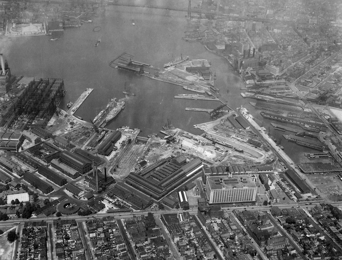
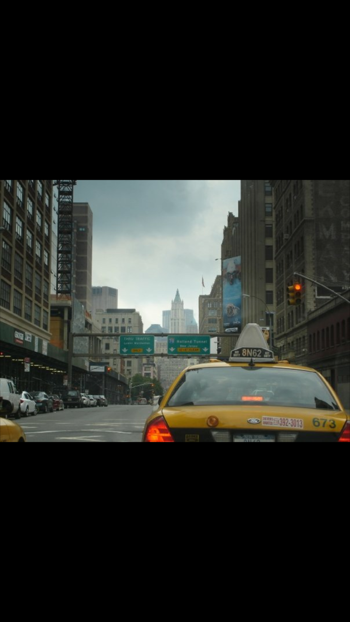
Financial District South of the Brooklyn Bridge and Barclay Street

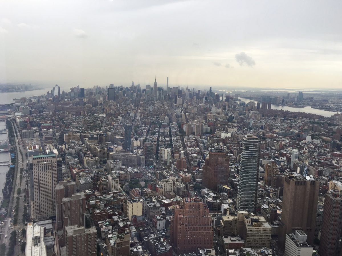
This neighborhood is the third largest business district in the U.S. after Midtown Manhattan and the Chicago Loop.  It contains the colonial-era town and several of New York’s remaining Revolutionary War sites.  The New York Stock Exchange, World Trade Center complex, and several other large skyscrapers call this area home.  The South Street Seaport is located here in addition to ferry terminals for Staten Island and Governor’s Island.

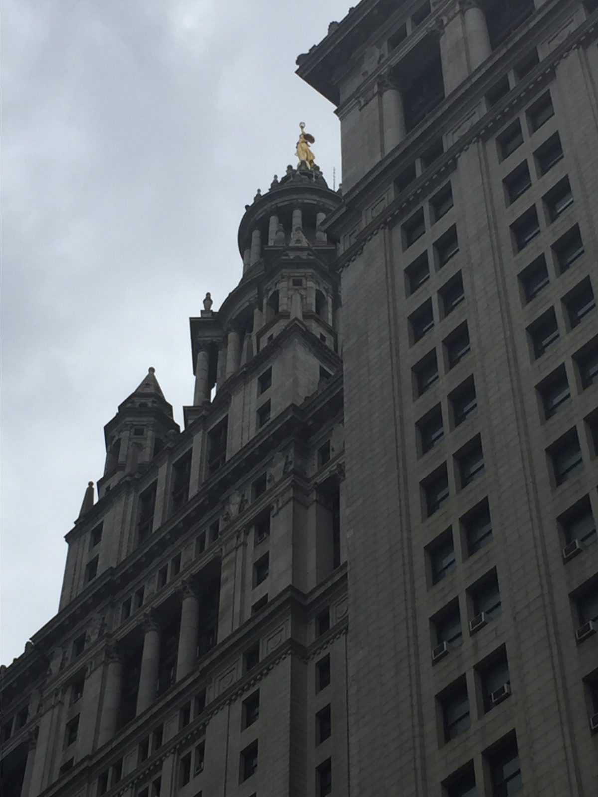
Civic Center East of Broadway, south of Columbus Park

The Civic Center contains the City Hall, Municipal Building, headquarters of many city agencies, and court buildings for the federal, state, and city governments.  It is most distinctive for its stately administrative buildings from different architectural eras and as the Manhattan end of the Brooklyn Bridge.

SoHo and TriBeCa SoHo is south of Houston Street and bounded by Canal Street and Lafayette Street.  TriBeCa is wedged into a triangle below Canal Street that is bounded by Broadway and Barclay Street

Both former commercial and industrial areas, SoHo and TriBeCa were later colonized by artists and bohemians, who were later followed by professionals.  Both neighborhoods are known for cast-iron buildings (many of which are now lofts or expensive residences).  These two neighborhood names were created as a construct of real estate agents (the same naming conventions are now applied to areas all over the city).

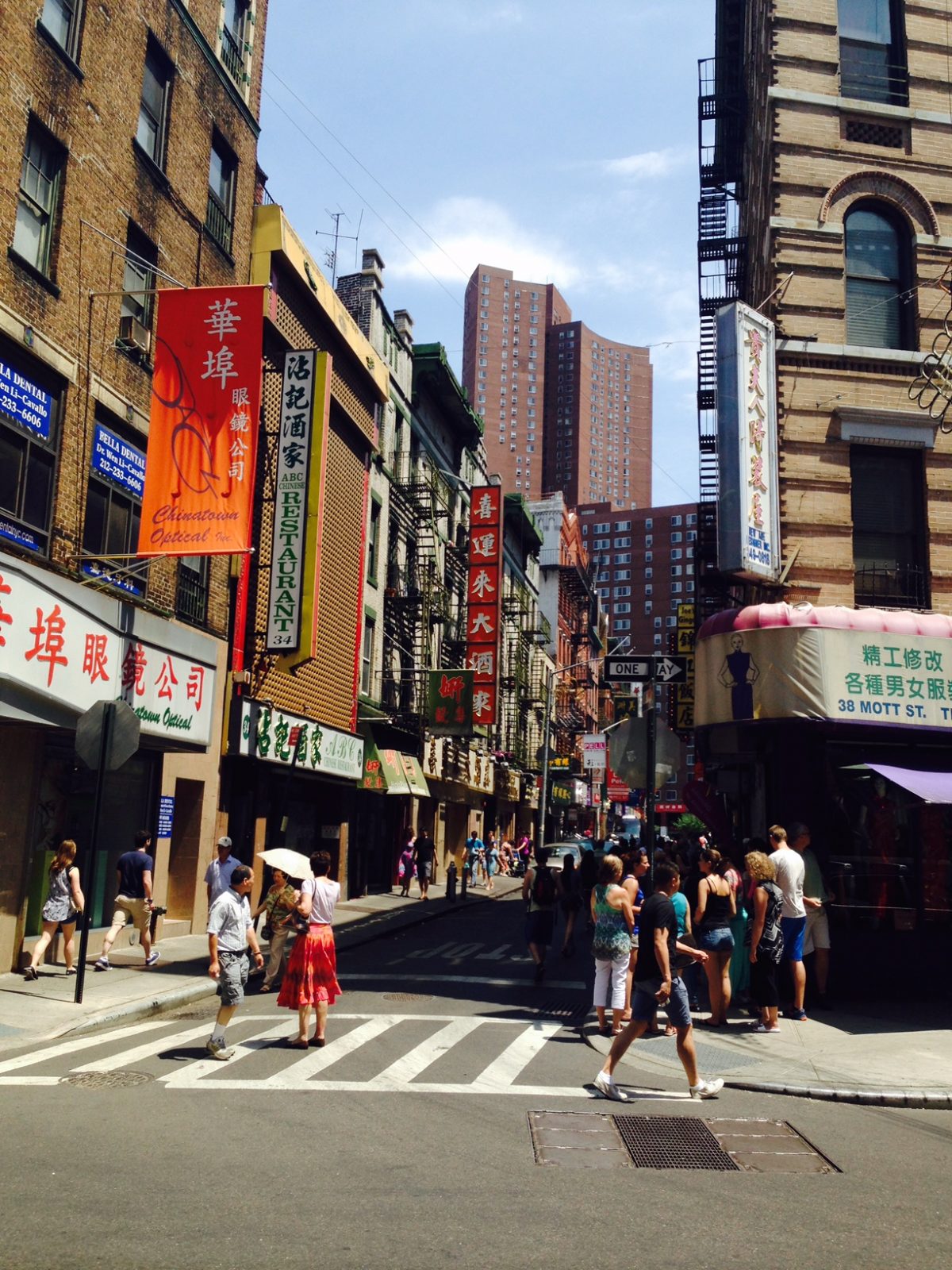
Chinatown and Little Italy Bounded by Lafayette Street to the west, Houston to the north, Allen, Broome, and Essex Streets to the east, and Columbus Park to the south

These Lower Manhattan neighborhoods are historic immigrant neighborhoods.  Most of the area is taken up by Manhattan Chinatown, which has historically been made up of Cantonese people.  In recent years, people from other parts of China and Vietnam have established themselves in the neighborhood.  Italians have historically lived in the north part of the district, but are now found along Mulberry Street north of Canal Street.  A section around St. Patrick’s Old Cathedral is called “North of Little Italy”, which is a fashionable area.

Lower East Side-East Village South of 14th Street, hemmed in by the East River on the East, Broadway to the west, and snaking east of Allen, Broome, and Essex Streets

Although inhabited by immigrants of many nationalities, the Lower East Side is most known as its traditional role as the Jewish neighborhood of New York.  From the late 1800s until after World War II, the area was one of the largest Jewish centers of the world.  Although there are still traces of the Jewish presence in the area such as grand synagogues and restaurants, the area has become more mixed, with many Puerto Ricans arriving after World War II.  Today, young professionals are moving into the area.  North of Houston, the area can be divided into “Alphabet City” around Avenues A through D and the East Village in the other areas north of Houston Street.

Greenwich Village Hudson River is to the west, 14th Street to the north, Lafayette and Broadway to the east and Canal Street to the south

The former independent town of Greenwich, NY, Greenwich village is known for being the home of NYU and Washington Square Park.  As it was a different town initially, it has a unique street grid.  It is perhaps most famous for being the preserve of famous writers from the late 1800s to the 1960s.

Chelsea-Union Square-Flatiron District Between 14th Street to the south and 34th Street to the north and hemmed in by the Hudson on the west and the East River on the east.  Chelsea is west of Fifth Avenue.  Union Square is east of Fifth Avenue.  This area contains many smaller neighborhoods.

Chelsea is a residential area named after the soldier’s home in London.  It was formerly a residential and industrial area, now commercial and residential.  It is known to native New Yorkers as the location of the Chelsea Piers recreational complex.  The area is home to the High Line and many new businesses in the Meatpacking District, a neighborhood in the southwest part of Chelsea.  Union Square is centered where Fourth Avenue, Fifth Avenue, and Broadway all meet.  It is where New York units departed the city from during the Civil War and is today a popular site for protests.

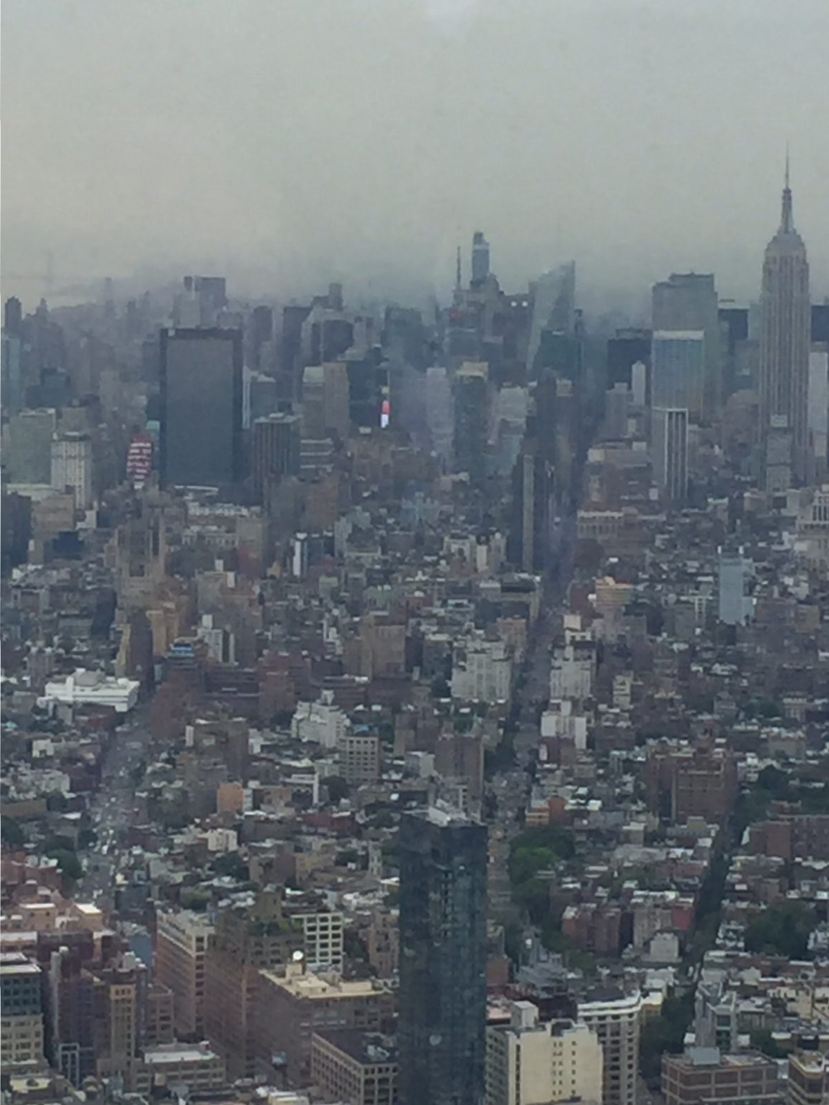
Midtown Bordered by the East River to the east, Eighth Avenue to the west, 59th Street to the north, and 34th Street to the south.

In a city already unofficially titled the center of the universe, Midtown is the center of that center.  It is home to the largest business district in the country, massive skyscrapers containing corporate headquarters, the United Nations, Grand Central Terminal, and the Museum of Modern Art.  Large hotels are found in this area.  Other attractions are the Chrysler Building, Rockefeller Center (along Fifth Avenue in the high 40’s-low 50s), and Times Square (centered at the confluence of Broadway, Seventh Avenue, and 42nd Street).  The Empire State Building at 34th Street and 5th Avenue is located at the extreme southern end of Midtown.

Hell’s Kitchen bordered by the Hudson River to the west, 59th Street to the north, 34th Street to the south, and Eighth Avenue to the east

Penn Station is located at its extreme southern end.  Once known as a very gritty area (hence the colorful name), Hell’s Kitchen remains a residential area that has become increasingly popular with people working in Midtown.  It is also the site of the Hudson Yards megaproject, which will create a city-within-a-city like Rockefeller Center.  The U.S.S. Intrepid is moored here.  If you arrive to the city by cruise ship, you will debark your ship in this neighborhood.

Upper East Side Enclosed by 59th Street to the south, 96th Street to the north, Fifth Avenue to the west, and the East River to the east.

A well-to-do area since the early 1900s, the Upper East Side is known for its proximity to Central Park, stately apartment buildings along Fifth Avenue and Park Avenue, and the world famous Museum Mile along Fifth Avenue that includes the Metropolitan Museum of Art and the Guggenheim Museum among others.

Upper West Side Enclosed by Central Park West to the east, the Hudson River to the west, Central Park North to the north, and 59th Street to the south.

This area is mainly a residential district.  Among several of the sites, in addition to Central Park, is the American Museum of Natural History.  The Lincoln Center is also in this area.

Harlem southern boundary at 96th Street/5th Avenue/Central Park North, bounded by the East River on the east and the Hudson River on the west and 155th Street to the north

Named after the town of Haarlem in the Netherlands, Harlem was originally populated by Germans, Jews, and Italians, it is most known for being the center of African American life in the city.  In the 1920s, a flourishing of the visual and written arts led to the Harlem Renaissance.  After decades of neglect, Harlem is once again experiencing a renaissance.  This area is the home of Columbia University and several stately churches, and the Cathedral of St. John the Divine.  East of Fifth Avenue is Spanish Harlem/ El Barrio, a primarily Latino neighborhood.


Washington Heights and Inwood surrounded by the Harlem and Hudson Rivers on the north, east, and west.  Southern boundary is 155th Street.

Washington Heights is named for George Washington’s command post during the Battle of New York in 1776.  Initially populated by Irish and Germans and later African Americans, the area is known for its Dominican population today.  Washington Heights is known for the Cloisters (a division of the Metropolitan Museum of Art) and the Manhattan approach to the George Washington Bridge.  Inwood is believed to be the site where Peter Minuit purchased Manhattan.

Grand Central Terminal

Only in New York would mere commuters arrive in the most stately of train stations.  Grand Central Terminal has welcomed travelers into the city since 1913.  Although Penn Station has the title for the busiest train station in the country (and even that is far from the busiest in the world),  it has 44 platforms and 67 tracks, the largest in the world.  Grand Central also has a cachet that is richly deserved among train station enthusiasts and visitors to the city.

The current terminal, once property of the New York Central Railroad, was built to replace the former Grand Central Depot and Grand Central Station that once graced the site.  Completed in 1913, it was designed by Warren and Wetmore.  The terminal was New York Central’s answer to the recently completed Penn Station, built by the rival Pennsylvania Railroad.  Grand Central and Penn Station would be in competition until the rivals united as Penn Central in 1968.  The Pennsylvania Railroad had already demolished Penn Station’s overground sections to get money to the struggling company.  Penn Central sought to reduce the costs to the company by repurposing the Grand Central Terminal site as a skyscraper with the station underground.  The station became the center of a preservation battle until the Supreme Court upheld the constitutionality of New York City’s historic preservation laws.  The terminal would gradually be restored and come under the management of the Metropolitan Transportation Authority.  A massive project to connect the terminal to the Long Island Railroad and alleviate commuter pressure on Penn Station is currently underway.

Grand Central Terminal contains the most well-known meeting place in the city… the clock over the information booth in the central concourse.  The clock is valued at over one million dollars.  The star of the terminal, however, is the mural painted by Paul Cesar Helleu, which shows the constellations of the Northern Hemisphere.  The perspective, however, is flipped so that it is the view from heaven instead of the one we mere mortals see.  A shopping arcade and market remain popular among the thousands using the station daily.  Of interest to tourists are the Grand Central Oyster Bar on the dining concourse (known for its whispering galleries made of Guastavino tiling).

Grand Central Terminal remains a nerve center of Midtown Manhattan.  Its development helped to make Midtown the preeminent business center of the city.  Additionally, a space as utilitarian as a train station is elevated to a high art form here.  Consider seeing Grand Central as part of a Sights by Sam tour of Midtown Manhattan.

Act of Consolidation

Although there are larger cities in terms of area in the U.S. than New York (Jacksonville, Florida, covers more area), and there are other cities around the world that have more inhabitants, New York remains the largest city in population in the U.S. and still covers a large area (at over 300 square miles).  The current boundaries of New York date back to 1898.  The ramifications of this merger (called the Act of Consolidation) are still felt today.

New York eclipsed Philadelphia as the largest city in the U.S. by the time of the first census.  As New York grew, the neighboring cities also increased in population.  This was most notable in Brooklyn, which would eventually become the country’s fourth largest city.  As the population of the region increased, it was becoming apparent that one city government would function in a more efficient manner.  After the Civil War, Brooklyn and New York had combined fire and police departments.  The addition of the Brooklyn Bridge also helped to draw the two cities together even more.

Much of the opposition to consolidation came from Brooklyn politicians, who naturally feared their loss of control in the new city.  Their protests were drowned out by citizens in Brooklyn, who were upset about corruption scandals in the City of Brooklyn and that the municipality was having trouble finding clean water—while New York had a reliable source of fresh water piped in from the Catskill Mountains.

In 1896 the State of New York approved a consolidation of the City of New York (which included Manhattan and the Bronx), the City of Brooklyn, Richmond County (Staten Island), and Queens County.  Areas of Queens County rejected the consolidation and split off (with state approval) to become Nassau County.  The Bronx would be spun off into its own borough before World War I.  Under a new city charter, the city council would acknowledge the roles of the separate boroughs with an upper house called the Board of Estimate, which included the mayor, city council president, comptroller, and the five borough presidents.  This chamber was declared unconstitutional in the 1980s and abolished.

While some say that the Act of Consolidation marked a great decline for many years for Brooklyn (the city lost its professional baseball team and independent newspapers in the ensuing years) and Staten Island (which has unsuccessfully tried to separate from the city several times due to a perceived indifference from the city government), it has been argued that the consolidation was beneficial as it helped to streamline government throughout the region and helped to develop the metropolis into what it is today.  Information such as this is explained on every Sights by Sam tour.

What’s in a Name: A Brief History of the Borough Names

Traversing through New York City, named after King Charles II’s brother, the Duke of York, many new arrivals and some long time residents have wondered why the boroughs have their names.  This short guide should explain why the boroughs are called what they are:

Manhattan

The origins of the name are not agreed upon.  The name Manhattan could be a Dutch corruption of a Lenape or Munsee word for “Place of Many Hills”, “Place Where One Gathers Bows,” or the oft-quoted “Place of General Inebriation.”

Brooklyn

Brooklyn is named after Breukelen, a Dutch village.  Various sources say this further translates into “the Broken Land.”

Queens

This borough was named for Queen Catherine of Braganza, the wife of King Charles II, who was the sovereign when the English took what became New York from the Dutch.

Bronx

This area was named after Jonas Bronck, a Scandinavian settler (who was believed to be Danish, Swedish, or Norwegian, depending on who you ask) who was a major landholder in the area in the 1600s.

Staten Island

Staten Island was named by Henry Hudson for the Staten Generaal, then the name of the Parliament for the Netherlands.  In 1683, the island was reorganized into Richmond County, named after the Duke of Richmond, illegitimate son of King Charles II.

The naming of the city itself and the outer boroughs follows a consistent pattern with the Age of Discovery in naming areas after important people or landowners (this pattern is repeated all across the U.S., Canada, Australia, and New Zealand), or as a linguistic corruption of already existing local names (which was common at one point in India and is still common in many New York neighborhoods).  Another entry regarding some of the neighborhood names will come at another time.  You are able to learn this and other history like it on a Sights by Sam tour.

The Unisphere

The Census Bureau has reported that Queens County is the most linguistically and ethnically diverse county in the U.S., with over 130 languages spoken and nearly half of the population born outside of the U.S. or born to parents from abroad.  Queens has replaced the Lower East Side of Manhattan as the place where America begins for many recent arrivals to New York.

A fitting symbol of the sway that Queens has on the world (or vice versa depending on your perspective), is the Unisphere in Flushing Meadows-Corona Park.  Located slightly over half a mile away from the Mets-Willets Point Station on the 7 Line, the stainless steel globe, clocking in at 350 tons, 140 feet high, and 120 feet wide, was part of a display by U.S. Steel for the 1964 World’s Fair.  During the fair, the Unisphere had lit areas showing the world’s capital cities at night (this feature has been since discontinued).  The three orbits show the paths of the three satellites in Earth’s orbit that existed during the fair.  The Unisphere sits in front of the Queens Museum and on the former site of the Perisphere and Trylon, the main structures of the 1939 World’s Fair, held at the same location.

After decades of neglect, the Unisphere was restored and declared a city landmark in 1995.  The fountain lining the giant globe was also restored in the early 2010s as well.  According to a 2011 New York Times article, the island nation of Sri Lanka was blown off the massive globe during a freak tornado.  The NYC Parks Department immediately restored the island to its proper place off the coast of India.  The repair was appreciated immensely by New Yorkers hailing from the island nation.

Aside from the Unisphere, Flushing Meadows-Corona Park is one of the largest parks in the city and contains other attractions.  The New York Hall of Science, the New York State Pavilion (currently being restored), and the Queens Museum all reside in this park that was once the infamous “ash heap” F. Scott Fitzgerald wrote about in The Great Gatsby.  The Mets’ home at Citi Field and the U.S.T.A. Billie Jean King Tennis Center are nearby at the fringe of the park.  After appreciating the Unisphere and the other attractions, the 7 Line is nearby to whisk you away to Flushing Chinatown for some great dumplings or the multitude of other ethnic foods that can be found along the so-called “International Express.”  See Queens in a new light by booking a custom tour with Sights by Sam.

The Yellow Cab

One of the more ubiquitous symbols of a city are its taxicabs.  London is known the world over for its black cabs.  Hong Kong is known for its color-coded fleet of Toyota Crowns, and Indian cities have 1950s-vintage Hindustan Ambassador cabs plying their lanes.  New York is well represented by the yellow cab.  These conveyances form a crucial piece of the city’s transportation network, giving native and visitor alike a bumpy experience on their way between points A and B.

Cabs were first instituted in New York when horses still strode through the city.   Motorized taxis replaced carriages in the early 20th century.  Until Mayor LaGuardia was elected in the 1930s, the industry was largely unregulated.  During the height of the Great Depression, the city instituted a system of medallions to cut down on the number of taxis in the city (it was estimated that over 30,000 cabs were on the streets, with many not being able to collect any fares).  In 1967, the color of the cabs was set as yellow to make official taxis instantly recognizable (according to one legend, it was the police commissioner’s wife’s favorite color).  Yellow cabs tended to concentrate in Manhattan and around the two airports in the city, leading to vast areas of the city being underserved.  This led to black livery cars (illegally) picking up fares in the outer boroughs and Uptown Manhattan.  The advent of the borough taxi program in 2012 led to a fleet of lime-green taxis allowed to pick up in the Outer Boroughs and in Uptown Manhattan in order to bolster cab numbers and bring on-demand transportation to these areas.

Current estimates state there are over 13,000 cabs in the city.  They are regulated by the city’s Taxi and Limousine Commission.  These include both yellow and borough cabs.  In recent years, taxis have been facing increased competition from rideshare services, bringing the value of medallions down (which were at one point in the millions).  In the mid-20th century, many cab drivers were driving as a way to make extra money or as a second job.  Today, most drivers are recent immigrants to the city and country.  Although not of note to most visitors, city law prohibits cars used as cabs from serving in that capacity for more than five years, regardless of mileage.

You may be using a cab to arrive at or leave from a Sights by Sam tour.  Remember when riding in a taxi to buckle up, note the number of the cab (which will follow a 1A23 format if yellow or AB123 format if a borough taxi).  You should also remember to take your items with you as they may not be found again if you leave them.  It may also be hard to hail a cab between 4 and 6 PM (as this is during a major shift change for most cabs).  Despite rumors to the contrary, most cabbies are courteous and know where they are going.

Manhattan Chinatown

Situated between the Civic Center and the Lower East Side is Chinatown, one of the defining neighborhoods of Manhattan.  Up to 100,000 people, including recent immigrants and families that have lived in this part of Manhattan for over a century, all crowd into this area.  Chinatown remains one of the most vibrant neighborhoods in terms of sights, smells, and tastes (some of the best restaurants in town are located here).

It is believed that Chinese arrived in New York right before the Civil War and settled in the immediate area around Pell and Doyers Street.  As more Chinese (soldiers and laborers) came to New York, discrimination against them increased.  Chinese men (it was mostly men who immigrated) often joined secret societies (tongs) that often warred against each other.  It is believed that conflict between tongs using hatchet men (hatchets were the weapon of choice) led to Doyers Street in Chinatown becoming the scene of the most murders of any spot in the city.  After immigration reform in 1965, the population of Chinatown exploded and the neighborhood expanded its boundaries.  Owing to the original arrivals and more recent arrivals from Hong Kong, Cantonese is the dominant language in Chinatown—but this is slowly changing as the most recent immigrants arrive speaking Mandarin.  The Chinese population in New York now numbers close to one million and counts Flushing in Queens and a Brooklyn Chinatown with Manhattan Chinatown (all linked together by bus companies serving the three locations).

One of the favorite pastimes of Chinatown for visitors is the food.  There are many opportunities to get snacks such as candy, Chinese baked goods, bubble tea, dim sum, or a full-course Peking duck meal.  In terms of more historic sites, Columbus Park (the last surviving part of the old Five Points), numerous temples, and the Museum of the Chinese in America are all available.

Chinatown, for its vibrancy, history, and great food, should be on the must-see list for any visitor to New York.  You are able to see Chinatown on most Sights by Sam tours of Lower Manhattan.


Holland Tunnel

Every workday, the population of Manhattan doubles as an army of 1.5 million commuters storm the island.  Commuters come by land and sea (with what I imagine are quite a few by air as well).  Many commuters and visitors come into Lower Manhattan via the Holland Tunnel, one of the notable crossings of the city.

The idea for a vehicular tunnel crossing the Hudson River was postulated as early as the first decade of the 1900s, following the completion of railroad tunnels by the Pennsylvania Railroad.  Originally, designers wanted a bridge (including some designs of a “London Bridge” motif with buildings on the bridge).  This was shelved as the Hudson River was the epicenter of the Port of New York at the time and it was feared a bridge’s construction would interfere with river-borne commerce.  An innovative proposal consisting of a tunnel consisting of two tubes with two lanes each was agreed upon.

Contrary to popular belief, the Holland Tunnel is not named for the country nor that same country’s association with the city.  The lead engineer of the project was named Clifford Holland, the project’s initial engineer.  Holland did not live to see the project completed, so Norwegian-born engineer Ole Singstad  led the project to completion. Begun in 1920 and completed in 1927, the tunnel was one of the first that was strictly vehicular in the world.  It is now managed by the Port Authority of New York and New Jersey, which runs the seaports, commercial airports, and crossings between New York and New Jersey.

The tunnel is revolutionary in that it solves the problem of pollution by cars with a system of ventilating fans.  Large, high powered fans, via ventilation towers in Jersey City and New York, exchange the air every ninety seconds.  Trucks are not allowed in the tunnel (due to safety restrictions and that the height of the tunnel is about a foot too short for your average semi to enter).  The tunnel is a characteristic white color that is believed to reduce road rage—it is brushed regularly with a special “toothbrush truck” the Port Authority has on hand for that purpose.  About 35 million vehicles use the tunnel annually.

Although existing in the same city as the soaring George Washington and Brooklyn Bridges, the Holland Tunnel is still notable.  Although thousands pass through it every day without noticing, the structure is a remarkable piece of civil engineering and a symbol of human ingenuity.  This is the type of information you will learn on a Sights by Sam tour.

Grant’s Tomb

Given that New York City is the home of only one president (Theodore Roosevelt), it would seem odd at first glance that a president who was born in Ohio and lived much of his adult life in Illinois would be buried there.  With that said, Ulysses S. Grant is the only president interred within the city limits, along with his wife, Julia.  The story of the tomb is compelling and is a comment on changing times in the city.

Grant died of throat cancer in Upstate New York in 1885 (rumored to be from his hard drinking and heavy-smoking ways).  While he was not a memorable president, his command of the Union Army in the Civil War and his influence on warfare gave him everlasting fame.  Grant’s family agreed to have him buried in New York.  An association (the Grant Monument Association) was formed to raise money for and construct the tomb.  After delays regarding its location, funding, and design, the tomb opened in 1897, with the mausoleum patterned off of the Mausoleum at Halicarnassus, one of the Seven Wonders of the Ancient World.  The spartan interior of the mausoleum was decorated in the 1930s with paintings of famous scenes from the Civil War and busts of other great Civil War generals.

The tomb began to suffer serious decay starting in the 1950s, becoming a vandalized, graffiti scarred mess.  The tomb was hardly visited and became a symbol of decay in the city.  Grant’s relatives threatened to remove his and Julia’s bodies to another location if something was not done.  After the National Parks Service was unwilling or unable to do anything,  a Columbia University student successfully got the gears moving by getting the Illinois state government to threaten to move President and Mrs. Grant’s bodies.  The federal government eventually appropriated money to restore the tomb.  The restoration of the tomb was completed in 1997.  In a tomb fit for one of the giants of American history, the interior and exterior are now in immaculate condition.  The interior contains the tombs and scenes of pivotal Civil War moments, such as the surrender of the Confederates at Appomattox.  There is also a collection of flags used in battle in the Civil War.

Although Grant’s Tomb does not figure highly on the itineraries of many visitors, it is an architectural master work and a slightly larger-than-life tribute to a giant of American History.  Grant’s Tomb can be seen on a Sights by Sam tour.